Pick a place
Search anywhere on Earth and choose a two, five or ten kilometre area.
Built for Hack the Habitat 2026
WildGap turns uneven biodiversity records into clear, safe field missions for school eco-clubs and citizen scientists.
The problem
“Data is often collected where resources are available, not necessarily where biodiversity threats are greatest.”
UNEP Nature Action Note ↗From gap to action
WildGap never says fewer records mean fewer animals. It asks a narrower, defensible question: where would another observation improve coverage most?
Search anywhere on Earth and choose a two, five or ten kilometre area.
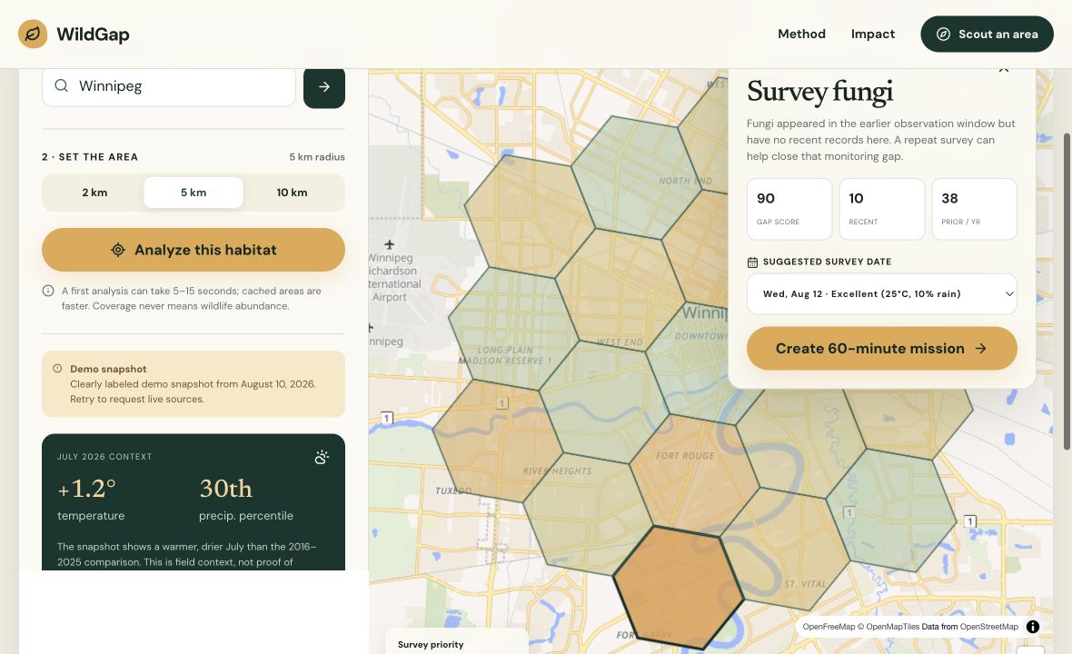
Compare recent GBIF observation coverage with the three-year baseline across H3 cells.
Use weather conditions and historical climate context to plan a comfortable outing.
Take a printable mission card, survey safely and link evidence when you return.
Transparent by construction
Every ranked cell exposes the same three ingredients. Climate data helps choose when to survey; it never changes the biodiversity gap score.
Winnipeg demo
The timestamped Winnipeg snapshot makes the full product flow reviewable during third-party outages. This submission claims deployed software and technical verification—not a completed Winnipeg outing or independent human study.
Open demo analysisVerification ledger
Measured honestly
These privacy-friendly counters reflect missions created and completed on this device.
A fast local comparison that stays readable on a phone.
The latest 12 months versus an annualized three-year baseline.
Below the evidence floor, WildGap suppresses the leaderboard.
A coverage gap is a reason to look—not evidence of ecological decline.
Judge the evidence, not the ambition. Planned surveys never count as completed visits, and evidence links remain optional but visible.
Your neighbourhood is next